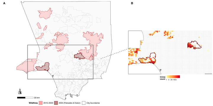
Abstract
Natural disasters can fundamentally disrupt the social and physical environments of urban areas, reshaping the conditions under which crime occurs. This study examines how major wildfires have influenced crime patterns across Los Angeles County, CA, from 2015 to 2025. Drawing on opportunity-based frameworks from environmental criminology, we assess how displacement, guardianship disruptions, and land-use change after wildfires can alter spatial and temporal crime dynamics. A dataset of 27,612 geocoded crime incidents was aggregated to 1-km2 grid cells for analysis. Mann–Kendall tests within a space-time cube identified significant temporal trends, geographically weighted regression (GWR) measured spatial heterogeneity in wildfire-crime relationships, and a distance-of-distances analysis evaluated post-wildfire shifts in the dispersion of crime events. Results show that wildfire-exposed areas were significantly more likely to experience long-term decreases in crime than unexposed areas, with suppression effects concentrated near burn perimeters, while crime events shifted farther from wildfire centers in the post-wildfire period. GWR results revealed strong local variation, indicating geographically uneven wildfire impacts. Together, these findings suggest that wildfires reshape both the magnitude and geography of urban crime. The study advances the geography of crime by integrating spatial data science, environmental risk, and criminological theory, demonstrating that disasters may sometimes suppress rather than amplify criminal opportunities.